CONTEXT
The Portuguese Living Lab extends over two case study areas.
The first is a forested landscape in Vale do Sousa that extends over 14316 ha. Eucalypt and maritime pine are the current main forest species and yet the landscape mosaic also includes agriculture units, urban areas as well as shrubland and abandoned agriculture areas.
The second is located in the Municipality of Lousã. It is classified as a Site of Community Importance, Serra da Lousã, of the Natura 2000 network. Mostly forestland (58.6% – 10 385 ha) dominated by maritime pine stands.
FIRE MANAGEMENT IN PORTUGAL
IN VALE DO SOUSA
About 46% of the Forest Intervention Area (ZIF) of the Vale do Sousa has burned in the last 9 years. This figure showcases that the identified area is characterized by a landscape vulnerable to wildfires and specific attention is needed to develop strategic interventions. To this end, more than 360 landowners (e.g., NIPF, Forest industry, Land Investment Funds, Municipalities) are associated within Associação Florestal de Vale do Sousa to develop a joint landscape-level management plan and reduce wildfire risk while providing other products and services.
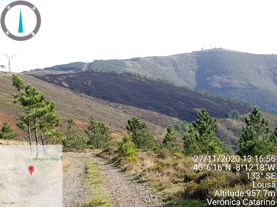
IN LOUSÃ
The Municipality of Lousã includes an Integrated Landscape Management Area (AIGP) of 8100 ha that is located in the Natura 2000 site. In recent years, prescribed burnings have been conducted to maintain the primary fuel break network, wildfire prevention, and training with the support of the Portuguese National Fire Service School.
CHALLENGES
- How to facilitate forest management collaborative planning integrating wildfire management?
- How to estimate the impact of management options on landscape resilience?
- How to design and plan landscapes that are more resilient to wildfires?
- How to improve risk communication effectiveness to reduce accidental fire ignitions caused by debris burning and leisure activities in the WUI?
- How to improve the understanding of the link between the exposure to smoke and air pollutants from fires and health and well-being in local communities and first responders?
INNOVATION ACTIONS
Emergency, Risk Mapping and Sustainable Fire Management Models
IA 1.1. Piloting an adapted Forest Fire Potential Polygons methodology to improve decision making on EW
IA 1.2. Testing key inputs for atmospheric data analysis using new knowledge and expertise on EWE
IA 1.3. Piloting early-warning indicators of EWEs incorporating fire-weather and vegetation conditions
IA 1.4. Integrated fire management model: bases, demonstration and piloting activities
Ecosystem Conservation and Landscape design
IA 2.3. Defining recommendations for improving security on WUI at multiple scales
IA 2.4. Optimizing landscape configuration and fire management policies to minimize expected losses from EWE
IA 2.5. Designing strategic networks of managed areas to improve suppression efforts against EWE
IA 2.8. Trade-off ES assessment of fire-resilient landscape design
Governance, Society, Communication and Risk Awareness
IA 4.2. Testing a new methodology for risk communication to improve WUI homeowners’ culture of risk for insurance products against EWE
IA 4.3. Fire Education Platform – An immersive tool for policy-makers, schools and families
IA 4.4. Fire-safe villages
IA 4.5. Testing regional-level policy clinics for inclusive and coherent firesmart risk governance
IA 4.6. Piloting a fire-wise planning platform and conceptualization tool
Advanced Technology Solutions - Support Tools for Integrated Fire Management
IA 5.1. Demonstration of an integrative umbrella system for estimating EWE risk and impact in real time with HR weather data
IA 5.2. Demonstration of real-time EWE simulation and smoke spread based on coupled fire-atmosphere approaches using of HR weather data
IA 5.4. Piloting models for fire combustion and Pyrocumulonimbus with use of HR data
IA 5.5. Testing of vertical atmospheric structure models based on satellite constellation in EWE
IA 5.6. Prototyping HAPS (High Altitude Pseudo Satellites) contribution to Europe’s resilience against EWE
IA 5.7. Quantifying impacts of exposure to air pollutants from wildfires
IA 5.8. Prototyping and testing innovative tools for EW ICS training certificates
IA 5.10. Development of a Pan-European system to define management priorities to mitigate fire impact
Factsheets
A set of factsheets was produced by forestWISE to interactively complement the information available on the Living Lab.


INTERACTIVE DASHBOARD
An interactive Dashboard dedicated to the Portugal Living Lab was produced by ForestWISE and can be consulted here.
PARTNERS
{{ group }}
{{ object.name }}
{{ object.name }}
{{ object.subheader }}
{{ icon.replace(/^icon_/, '') }}
{{ label }}
Contact
José G. Borges
- Instituto Superior de Agronomia - Universidade de Lisboa
- joseborges@isa.ulisboa.pt
Brigite Botequim
- ForestWISE
- brigite.botequim@forestwise.pt