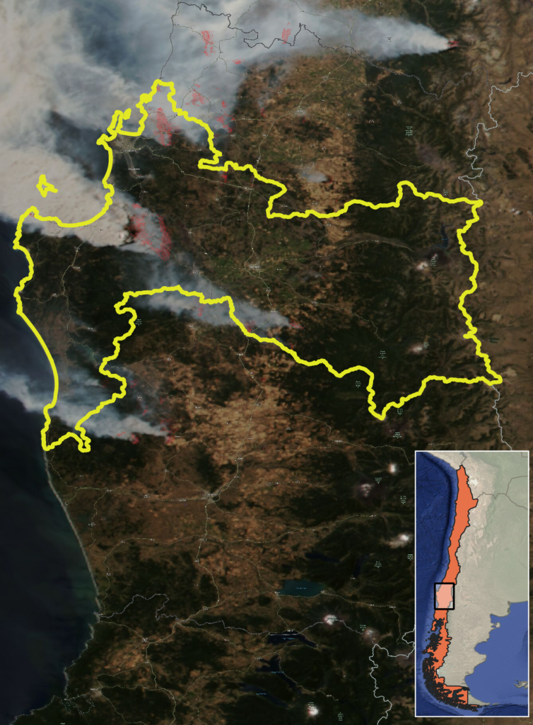
CONTEXT
The Living Lab in Chile will be situated in two different zones. The first, Concepción, includes the capital city of Biobio Region, and its surroundings communes, for a surface of more than 3,200 km2. The second, Constitución and Empedrado, are two adjacent municipalities, mostly rural (more than 1,900 km2).
Both areas, together and separately, have a very diverse composition not just at a landscape level but also at an anthropogenic level, i.e. the building materials of the houses and configuration of ornamental vegetation. There are 3,760 small forest owners considering both areas, as well as six medium and three large forest companies.
FIRE MANAGEMENT IN CHILE
By law, the fire management is in charge of the Ministry of Agriculture, which is exercised through the National Forestry Corporation (CONAF).
At the same time, some forest owners have their own specialized personnel to face forest fires. Both organisms work together in prevention and suppression.
Prevention is done by conventional preventive silviculture techniques and fire suppression techniques occur through direct and indirect techniques.
CHALLENGES
- Landscape data are not actualized
- Low resolution of climate and weather data
- The large number of landowners in the area may make it difficult to achieve representative participation
INNOVATION ACTIONS

Emergency management – 1 Innovation Action
- IA 1.2 Testing key inputs for atmospheric data analysis using new knowledge and expertise on EWE

Landscape and economy- 3 Innovation Actions
- IA 2.3 Defining recommendations for improving security on WUI at multiple scales
- IA 2.4 Optimizing landscape configuration and fire management policies to minimize expected losses from EWE
- IA 2.7 Landscape design strategies, using tactical planning methods

Governance, society, communication and risk awareness- 1 Innovation Action
- IA 4.4 Fire-safe villages
Advanced Technology Solutions - Support Tools for Integrated Fire Management- 8 Innovation Actions
- IA 5.1 Demonstration of an integrative umbrella system for estimating EWE risk and impact in real time with HR weather data
- IA 5.2 Demonstration of real-time EWE simulation and smoke spread based on coupled fire-atmosphere approaches using of HR weather data
- IA 5.3 Advanced vegetation characterization based on Earth Observation data fusion and Artificial Intelligence over forestland ecosystems
- IA 5.4 Piloting models for fire combustion and Pyrocumulonimbus with use of HR data
- IA 5.5 Testing of vertical atmospheric structure models based on satellite constellation in EWE
- IA 5.6 Prototyping HAPS (High Altitude Pseudo Satellites) contribution to Europe’s resilience against EWE
- IA 5.9 Tools for international collaboration through shared operational information for specialized stakeholders
- IA 5.10 Development of a Pan-European system to define management priorities to mitigate fire impact
PARTNERS
{{ group }}
{{ object.name }}
{{ object.name }}
{{ object.subheader }}
{{ icon.replace(/^icon_/, '') }}
{{ label }}
Contact

Rodrigo Mahaluf
- Instituto Sistemas Complejos de Ingegneria (ISCI)
- rodrigo.mahaluf@ug.uchile.cl