IA 5.3. Advanced vegetation characterization based on Earth Observation data fusion and Artificial Intelligence over forestland ecosystems
OVERVIEW
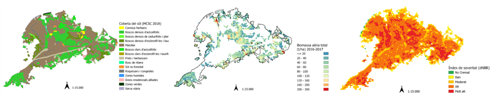
What kind of result is this? | New methodologies based on remote sensing datasets to check evolution of key forestland metrics and phenological parameters. | |
What’s the area addressed? | Advanced Technology Solutions | |
What’s the covered phase? | Restoration & Adaptation | |
What’s the addressed challenge? | How to measure in a feasible and viable way as well as high latency the changes and evolution of key post-fire metrics? | |
What value is proposed? | A pilot of forestland fuel mapping, its changes (e.g. soil moisture, vegetation water) and tendencies, monitor post-fire vegetation recovery (e.g. geospatial wildfire contours, fire severity) will be implemented through data fusion of EO multi and hyperspectral datasets, LiDAR data and machine learning approaches | |
Who can use it? | Policymakers and researchers involved in forestland policies, recovery and management | |
What type of tool is it? | Geoinformation Layers to an API to consul as geoservice | |
How does it look like? | Shapes, raster files and CSV datasets | |
This tool is… | ⊠ a new tool | ☐ an improved tool |
What are the vision & mission statement? | To generate and “automatic” flux and anomalies detection based on A.I. architectures to suit the API and associated geoservice | |
When will it be complete? | Mid 2024 | |
Documentation | TBA | |
This IA is implemented in the Living Lab(s)… | ||
Contact
Jordi Corbera
- Cartographic and Geological Institute of Catalonia (ICGC).
- jordi.corbera@icgc.cat;
Julià Talaya
- Cartographic and Geological Institute of Catalonia (ICGC).
- julia.talaya@icgc.cat