IA 2.3. Defining recommendations for improving security on WUI at multiple scales
OVERVIEW
What kind of result is this? | Guidelines & Recommendations | |
What’s the area addressed? | Ecosystem Conservation and Landscape design | |
What’s the covered phase? | Prevention and Preparedness | |
What’s the addressed challenge? | How to increase the fire resistance of wildland urban interfaces? | |
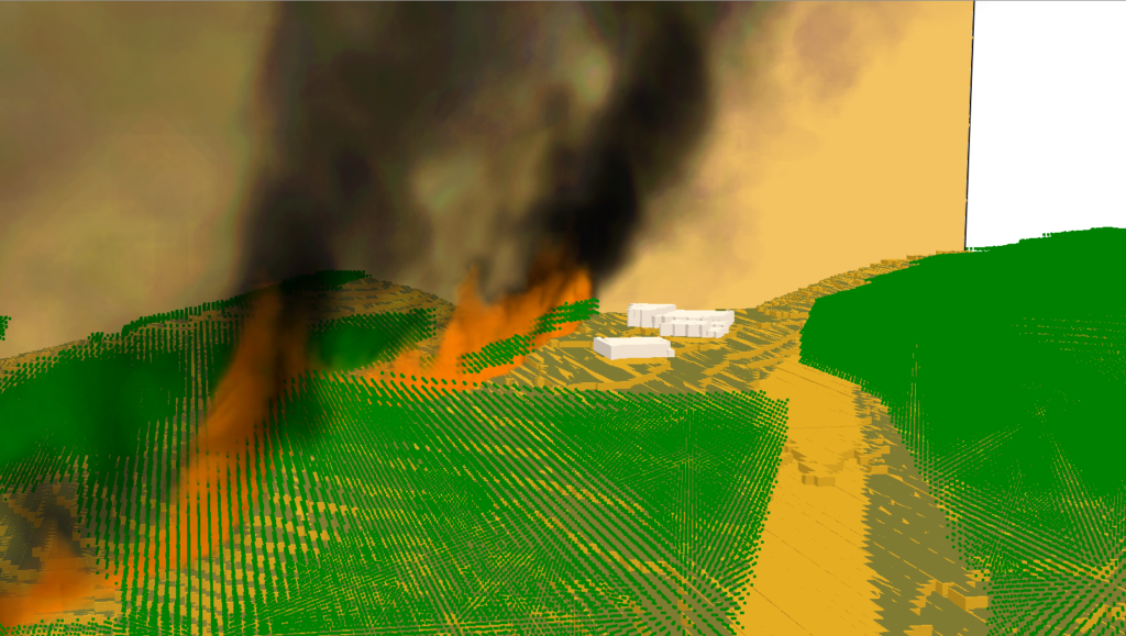
What value is proposed? | Providing recommendations for the landscaping around the buildings in the WUI and the choice of openings for the buildings to reduce the building vulnerability. Providing guidelines to determine the best allocation of fuel treatment in the rural part of WUI. | |
Who can use it? | Policymakers and WUI residents | |
What type of tool is it? | Report | |
How does it look like? | Text | |
This tool is… | ⊠ a new tool | ☐ an improved tool |
What are the vision & mission statement? | The work carried out in this I.A. focuses on two aspects of fires at wildland urban interfaces (WUI). On the one hand (ISCI), its objective is to define the best fuel treatment allocation in the rural part. A system has been developed that integrates several stages to support decisions on spatial assignment of firebreaks. The main characteristic is the smooth integration between Cell2Fire, a fire spread simulation model and decision-making algorithms. The optimum fuel treatment allocation considers different wildfires scenarios and the most likely behaviour of the fire after thousands of simulations. Because of this, the system will reduce the expected impact of any wildfire on the WUI. The system considers the important values-at-risk it aims to protect, that include human lives, infrastructure, carbon emissions, wildlife or any value defined by the Living Labs. The different models are integrated into a user-friendly QGIS Plugin system which is being implemented in several Living Labs. On the other hand (CNRS), it aims to increase the fire resilience of buildings at WUI. The openings have been identified as the main vulnerable points in the propagation of vegetation fires towards the interior of buildings. By scientifically defining safety distances between ornamental vegetation and these structural elements and by giving recommendations on the materials to be used, the risk of building ignition due to the deterioration of openings can be drastically reduced. The recommendations given in this IA could lead to the definition of a common European regulation for the management of vegetation around buildings in WUI as well as to building recommendations. | |
When will it be complete? | Early 2025 | |
Documentation |
| |
This IA is implemented in the Living Lab(s)… | ||
Contact
Virginie Felicelli-Tihay
- Université de Corse Pasquale Paoli
- tihay_v@univ-corse.fr
Andrés Weintraub
- Complex Engineering Systems Institute- Instituto Sistemas Complejos De Ingenieria (Chile)
- aweintra@dii.uchile.cl