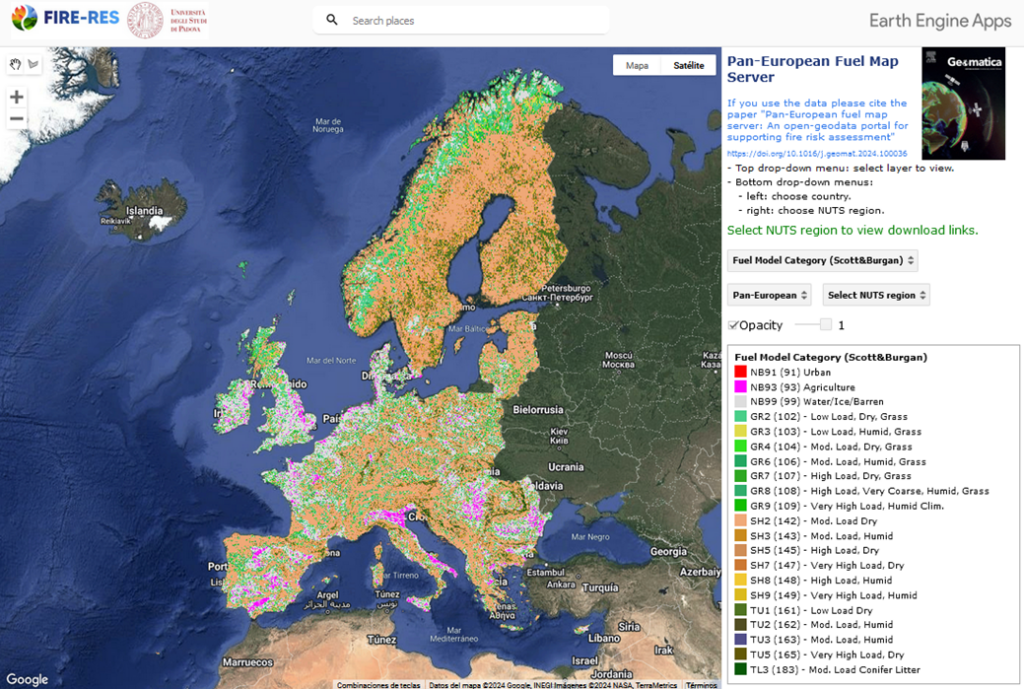
A collaborative work between the University of Padova and the Centre de Ciència i Tecnologia Forestal de Catalunya, in coordination with different Living Labs across Europe, has resulted in a geospatial tool designed to improve wildfire management. The newly developed FIRE-RES Pan-European Fuel Map Server, described in this latest scientific publication, offers cutting-edge data and tools for analysing and mitigating fire risks across the continent.
What Does the Fuel Map Server Offer?
This web-GIS server delivers a comprehensive suite of geospatial datasets, essential for wildfire simulation and risk assessment:
An aboveground biomass map produced through satellite data and artificial intelligence, which was used for canopy fuels.
Canopy fuels and surface fuel models, crucial for understanding fire spread and intensity.
Topographic data including elevation, slope, and aspect.
Uncertainty maps to gauge the reliability of canopy fuel estimations.
With all layers harmonized at a 100-meter resolution and accessible through a user-friendly web-GIS interface, stakeholders can seamlessly view, query, and download data tailored to their specific needs.

Why Is This Important?
Access to accurate, harmonized geospatial data is critical for fire management agencies, policymakers, and researchers to develop effective prevention strategies and emergency responses. This platform bridges a long-standing gap by providing open, reliable, and scalable data to address fire risks at national, regional, and local levels.
From fire management agencies to academia, local authorities, and even citizens this platform empowers users to make informed decisions based on robust, scalable data.

Key Innovations
Advanced Data Integration: Combining satellite observations, machine learning, and species-specific equations, the platform provides high-resolution maps for canopy base height (CBH), canopy bulk density (CBD), and more.
Interactive Access: Users can explore the data at multiple administrative levels (NUTS0–NUTS3) through a seamless web-GIS environment powered by Google Earth Engine.
Future-Ready Design: The system adheres to F.A.I.R. principles, ensuring that data is findable, accessible, interoperable, and reusable for maximum impact.